NGI and NOAA Partners at 2023 GOMA All Hands Meeting
July 20, 2023

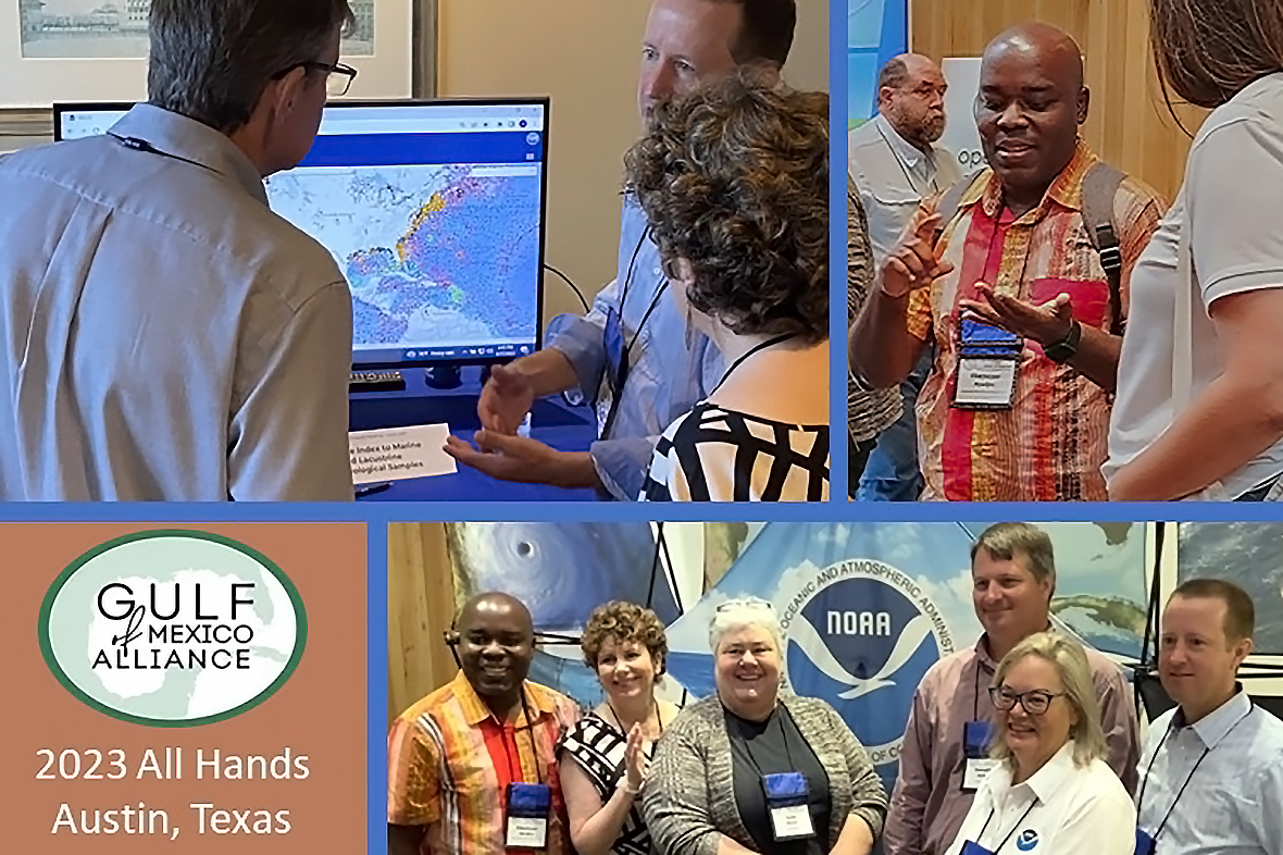
NGI and NCEI participants at the GOMA All Hands include (Top L to R) Clint Edrington and Angela Sallis speaking with an ESRI representative during the Tools Cafe; Ebenezer Nyadjro sharing information with a meeting attendee. (Bottom L to R) Ebenezer Nyadjro, Angela Sallis, Julie Bosch, Jonathan Jackson, Sharon Mesick, and Clint Edrington gather at the NOAA display. Photos by A. Sallis and M. Dannreuther
More than 450 people representing state and federal agencies, academia, non-profits, and industry gathered in Austin, TX for the Gulf of Mexico Alliance (GOMA) All Hands meeting June 26-29, 2023. Of those participants, 40% were first-time attendees of the event! The
meeting provided many opportunities for regional collaboration to enhance the environmental and economic health of the Gulf of Mexico.
What does collaboration look like in practice? Participants from the Northern Gulf Institute (NGI) and its partners with the National Centers for Environmental Information (NCEI) at the National Oceanic and Atmospheric Administration (NOAA) shared some of their experiences, which ranged from establishing new and strengthening existing relationships to learning about data users' needs and requirements and raising awareness about existing data products and services.
Connecting
Paul Mickle, NGI's Co-Director, interacted with sub-grantees and research partners during the meeting, "We discussed upcoming field and scientific activities, such as our hypoxia research and multiple data science grants." Paul supported NGI scientists who presented at various sessions and events as well as learned more about the region's data networks, especially during sessions with the
Data and Monitoring and
Integrated Planning teams, all of which inform future research plans. "While other venues have meetings or sessions that cater to a particular scientific discipline, GOMA has figured out a way to have multi-disciplinary teams – from scientists to project managers and outreach specialists – function efficiently."
Julie Bosch, with NCEI's Information Services Branch of their Oceanographic and Geophysical Science and Services Division, talked about having many refreshed conversations related to data management and sharing around the Gulf of Mexico. "Follow up activities are starting that will help us make various NCEI datasets and services available to more users, and we, along with other Data and Monitoring team members, are planning sessions for next year's Gulf of Mexico Conference."
First-time attendee
Clint Edrington, NGI's Marine Geology Data Manager for NCEI, felt that the meeting provided a good opportunity to network and set up next steps. "Not only do you meet people across the Gulf who work in one's field or related fields, but it also helps you stay in touch with these people," he said. "I have two in-person meetings planned to discuss potential collaborations that originated from conversations with scientists at the GOMA All Hands."
Seeking
Ebenezer "Eben" Nyadjro, an Associate Research Professor of Oceanography at Mississippi State University and affiliated with NGI and NCEI, offered a research project for consideration of support at the
Marine Debris Cross Team session. "I discussed the need for sampling the entire Gulf of Mexico for microplastics in surface and subsurface waters as well as in sediments and fisheries," he said. "I showed the group the
NCEI interactive microplastic map tool, explaining that a lot of data for the Gulf of Mexico is missing and asking them to share our map with their collaborators who will hopefully share their data with us." Eben also gave information about the microplastics database to a group from Eckerd College who developed the
Remora plastic tracking app to reduce single use plastics.
Jonathan Jackson, an NGI Fisheries Researcher and Data Manager for NCEI, made progress on improving data acquisition and processing for the
Harmful Algal Blooms Observing System (HABSOS). "I connected with members of the Texas Parks and Wildlife Department's HAB team and continued our discussion about developing an automated data stream," he explained. "I'm also hopeful about the potential to include an Imaging Flow Cytobot (a robotic microscope that automates in-situ phytoplankton monitoring) on their upcoming groundfish cruise as is done with the
Gulf of Mexico Hypoxia Watch." Additionally, Jonathan met with Florida Fish and Wildlife Conservation Commission staff involved with their HAB effort, Alicia Hoeglund (sampling and processing) and Jon French (IT). "We discussed their requirement to update the code that produces the data stream accessed by HABSGrabber (software that fetches and processes data from State providers), which feeds into the HABSOS."
Showing

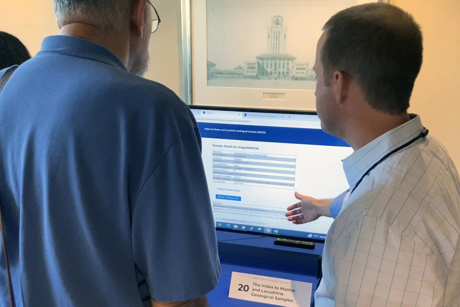
During the Tools Cafe, Clint Edrington with NGI (R) demonstrates the NCEI Index to Marine and Lacustrine Geological Samples (IMLGS), a web-accessible map viewer and database. Picture by M. Dannreuther
The Tools Cafe is a main event at the GOMA All Hands, with
twenty-seven demonstrations given at this year's gathering, where scientists share their data-derived products and resources in an interactive format with stakeholders from across the region.
One of those demonstrations featured the
Index to Marine and Lacustrine Geological Samples (IMLGS), a web-accessible map viewer and database, given by
Clint Edrington, who talked practically non-stop with a steady stream of visitors.
This resource enables researchers to discover and access not only digital geological data gleaned from seabed and lakebed samples collected worldwide but also physical samples curated at partner institutions underlying the digital data. "This event gave me the opportunity to promote the IMLGS to non-geological scientific communities, such as marine ecologists who could integrate this resource when assessing benthic habitat," said Clint.
Helping
Angela Sallis, a project manager for NCEI's Information Services Branch, assisted Clint during the Tools Cafe. "It's very helpful to have two people doing this, one demonstrating and one taking notes," she explained. "We collected feedback and requirements from 13 users who we can now add to our Salesforce customer service database for follow-up."
In addition to the Tools Cafe, Angela helped others become aware of NOAA data resources during the
Education and Engagement team session. The developers of a new online learning program "
Waters to the Sea: A Gulf of Mexico Adventure" asked for data resources as they continue work to improve it. Angela told them about several data products including the Ocean Explorer's
Digital Atlas and
Video Portal, the
North American Drought Monitor, and the webpage
Billion Dollar Weather and Climate Disasters.
The above experiences provide a snapshot of on-the-ground collaboration at the 2023 GOMA All Hands. To hear experiences of attendees from other organizations, click
here.
************
The
National Centers for Environmental Information is the nation's leading authority for environmental data, managing one of the largest archives of atmospheric, coastal, geophysical, and oceanic research and contributing to the mission of NOAA's National Environmental Satellite, Data, and Information Service with new products and services that enable better data discovery.
The
Northern Gulf Institute is a NOAA Cooperative Institute with six academic institutions located across the US Gulf Coast states, conducting research and outreach on the interconnections among Gulf of Mexico ecosystems for informed decision making. One of NGI's four research themes is Effective and Efficient Data Management Systems Supporting a Data-Driven Economy.
By
Nilde Maggie Dannreuther, the Northern Gulf Institute, Mississippi State University.

